10 hidden gems in Mauritius,You should visit in 2023
The reason I titled this piece "hidden gems" is because you can't just walk in and access these places. Some form of effort will have to be put such as walking and hiking.

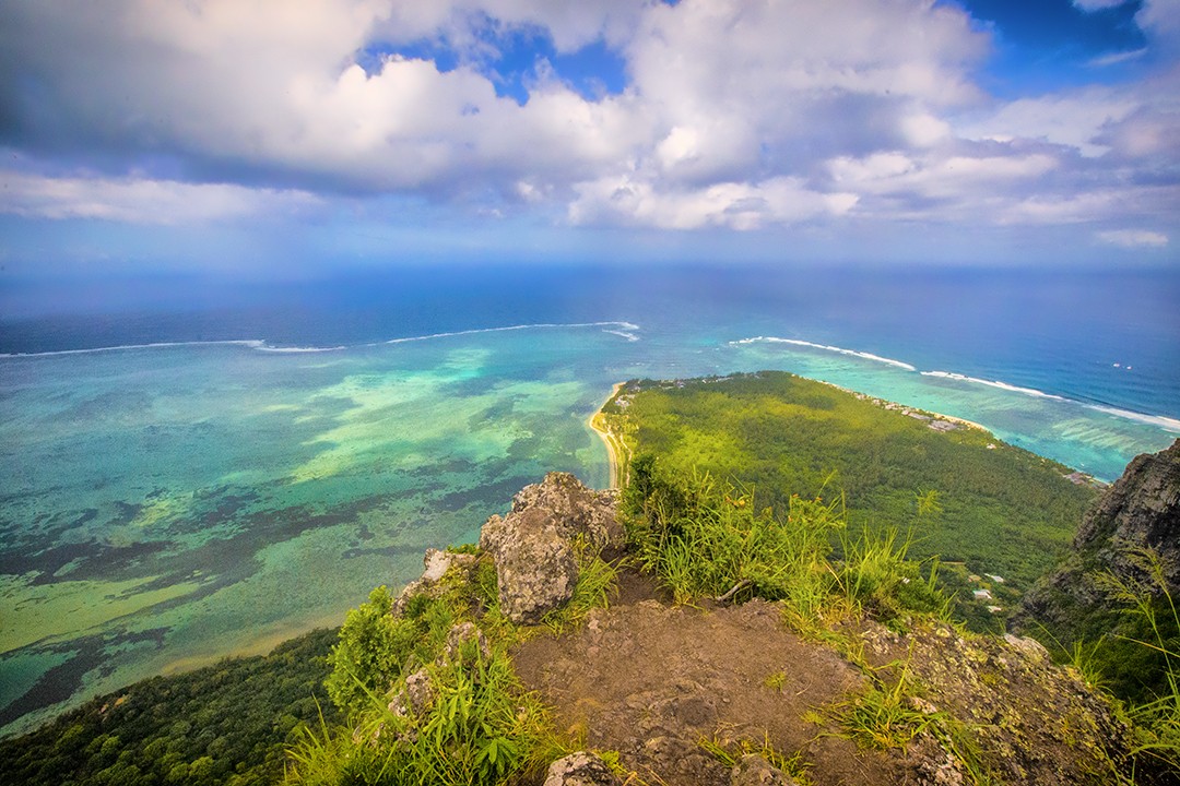
Off the north coast of Mauritius is Île Plate, sometimes referred to as Flat Island. The northernmost point of the mainland, Cap Malheureux, is 11 kilometers away from it. Between the two islands is the small natural preserve known as Coin de Mire. 13 kilometers to the east is the similarly sized island of Île Ronde. Near the beach of Île Plate are two little islets called Îlot Gabriel and Pigeon Rock. Île Plate, which has a low elevation as suggested by its name, may be flooded as a result of the long-term sea level rise. One of the island's few functioning lighthouses and a cemetery are among its buildings; the cemetery bears witness to the island's past use as a quarantine facility in the 19th century.

In Mauritius, Bassin Carangue is a rocky seaside with breathtaking views. We are showing you everything along the road that is interesting to look at, including the river mouth where it joins the sea.
3.Mare Longue Waterfall

Although I'm not sure if this waterfall has an official name, I'll call it Mare Longue waterfall because it can be located in the Black River Gorges along the Mare Longue route.
Here, two streams come together after running in different directions to form a crystal-clear pool of turquoise water. Although smaller, it resembles the waterfalls at Eau Bleue quite a bit. Also, the pool appears to be rather deep, so use caution if you want to swim.
This extensive walk circles the Mare Longue reservoir's banks and travels up ridges with views of nearby canyons. There are a few kilometers of foottrail that round the reservoir, but it primarily follows a well-marked dirt road that is shaded by trees. Although it is long, there is little elevation variation, making it only slightly difficult.
The Petrin park gate is where the hike starts. At all of the significant intersections, there are signs. To get to Mare Longue, follow the signage. You can circumnavigate the reservoir in either direction. The walk travels along a dirt road in both directions, but eventually a trail splits off to go around the reservoir's northern side. When you arrive at any significant intersections, regardless of your approach, just keep your clockwise or counterclockwise heading in mind. At one point, the head of a dam will be crossed. There are a couple stream crossings on the east side where you might have to get your feet wet, as well as a fantastic area of dwarf woodland. When you eventually return to the road you started on, take that route.
4.Telfair Garden

On the route to the Robert Edward Hart Museum and the Gris Gris, Telfair's Garden is ideally situated across the street from the Souillac Bus Station. It is a truly remarkable sight. This location, which more closely resembles a tiny city park than a true garden, was given its name in honor of Charles Telfair, the English governor's secretary, sugar baron, and manager of Sir Seewoosagur Ramgoolam's botanical gardens. The location of Hart's grave, Cemetery Point, offers a good view of Telfair Bay. Swimming is risky due to the strong currents that can create, a concrete slab warns you.You can travel through Mauritius' past by taking a leisurely stroll in this garden's fresh breeze..
Le Jardin de Telfair, which is situated in Souillac, stands apart from other gardens in Mauritius because, dare we say it, it is right next to the beach! You can therefore enjoy the sound of the waves in addition to strolling through serene natural settings enhanced by the freshness and greenery of plants and trees. You must admit that this pairing is amazing!
One of the nicest stops to make while driving through the southern part of the island is for a picnic at Jardin de Telfair. There is plenty of room for kids to play unsupervised.
The garden's splendor is concealed at the end, where you will find a stretch of beach with enormous waves breaking against the neighboring rocks, representing the south coast of Mauritius in its true, unadulterated, and untamed state.At the base of the park, he rocks.
5.Le Morne Secret Path
Discovering le morne Brabant - The slave route The Morne Brabant is a mountain of the south-west of Mauritius, on the peninsula of the Morne. Declared World Heritage by UNESCO since July 6, 2008, the site is a sanctuary for runaway slaves and is a strong cultural and patrimonial symbol for every Mauritian. Being on private land, Le Morne Brabant is one of the most preserved and wildest mountains of the island. It includes a multitude of endemic species, such as the rare Trochetia Boutonania, and its red flaming flower. The hike to the summit of Morne Brabant lasts between three and four hours, depending on the homogeneity of the group.
6.Cavendish bridge,Mahebourg, A Piroge(boat) on the water you can see the village alongside the river.

You will travel through the Cavendish Bridge, also known as the Ville-Noire Bridge, which was constructed under the British rule at the beginning of the 20th century, as you enter Mahebourg. Take a break on the island's 155-meter-long largest bridge!
Construction on the Mahebourg Cavendish Bridge started in 1908, and it was finished and opened in 1911. Because of the governor Cavendish Bhoyle who presided at the time, the Bridge is known as Cavendish.
The primary function of this bridge is to connect the Mahebourg Village to the "Ville Noire," as it is known on the opposite side. It minimizes the obstacles to getting to the East while also bridging the gap over the "La Chaux" River (Riviere La Chaux). As opposed to being entirely stoned, as was the case with bridges built before that time, this was one of the first bridges to use a concrete construction.
7.Bain des negresse Gris gris, A little bit of walk

Hidden behind a green curtain: Bain-des-Négresses. Located not far from La-Roche-qui-Pleure, this river is however little known. They are not good at adventuring. The few lucky ones who get out of the beaten paths are sure to have a unique contact with nature in its raw state.
There are no reefs there. There, the sea does what it wants, it disappears. The waves, powerful, crash on the cliffs. What is the impression of this region? of a wild beauty. If you know this facet of Gris-Gris, whoever tries to go beyond La-Roche-qui-Pleure will discover its quieter side, that of the river of Bain-des-Négresses.
To be geographically correct, Bain-des-Négresses “separates”, in fact, the villages of Saint-Aubin and Souillac. In front of the cliffs where the filaos have taken root, are the land of the sugar plant Union, in the village of Saint-Aubin.

Ilot Sancho, which wonderfully combines history and environment, is situated across a canal from Baie-de-Jacotet's beach. It used to be a famed naval spot where colonies would defeat one another. It may sound like something out of a history novel, but Mauritius is much more than just beaches, five-star hotels, and coconut trees. The area is a popular surfing place in the South.


It is feasible to walk from the shore to the lonely Ilot Fourneau during low tide. Walking across the lagoon while taking in views of Le Morne Brabant feels strange and is a truly singular experience. It is feasible to complete a loop around the island by walking in the sea and along the rocky shore.
Comments
Post a Comment